- Which ocean is the Baltic Sea part of?
- What is the coastline of the Baltic Sea like?
- What are the Baltic Sea coasts like?
What is the Baltic Sea?
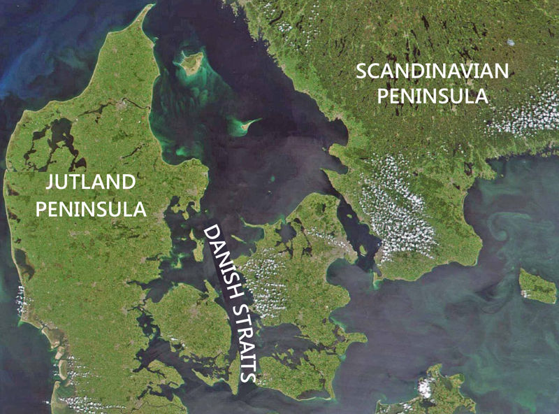
The Baltic sea is one of the inland seas of the Atlantic Ocean. The Baltic Sea, which reaches deep into the Eurasian continent, is separated from the ocean by the Scandinavian and the Jutland Peninsula but is connected to it by the narrow and shallow Danish straits.
Compared to the oceans and many other seas, the Baltic Sea is shallow. Off the coast of Sweden, near the island of Gotland, the seabed descends to a depth of almost 500 m, but the average depth is only 60 m. The average depth of the Atlantic Ocean is over 3,500 meters.
Think!
- Why is it often said that the sea not only separates but also connects lands and peoples?
The coastline of the Baltic Sea is very articulated
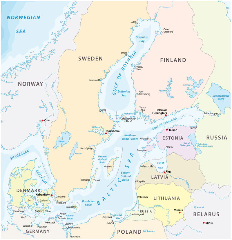
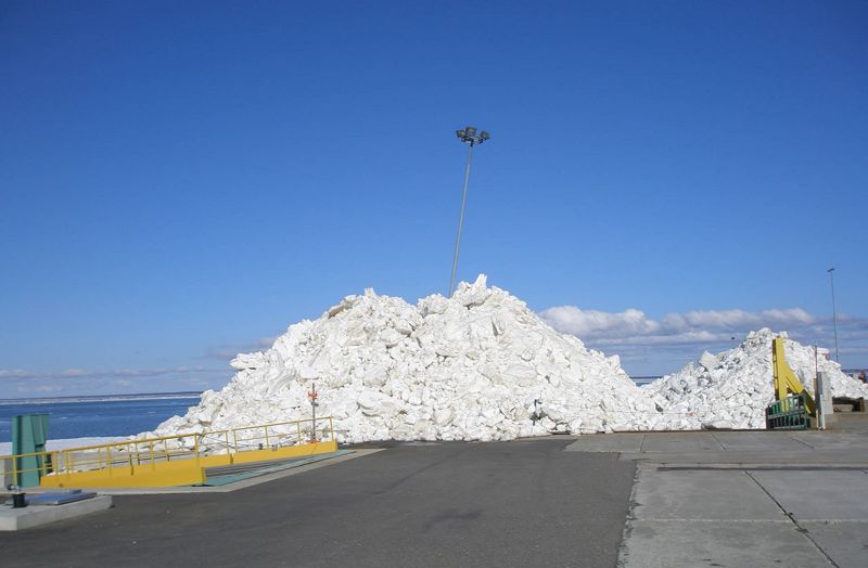
The coastline of the Baltic Sea is very articulated because of the numerous bays and the peninsulas alternating with them. Near the Estonian coast, three large bays reach deep into the mainland: the Gulf of Bothnia extends to the north, the long and narrow Gulf of Finland to the east, and the Gulf of Riga to the south. Estonian northern coast is especially rich in small bays.
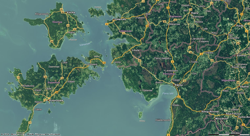
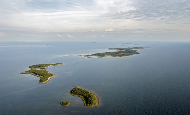
There are many islands in Estonian, Finnish and Swedish waters. Many of them have only recently emerged from the sea and are so small that they are often submerged during high water.
The coast of the Baltic Sea is changing
For several million years, the Baltic Sea and the surrounding area were pressed down by kilometres of continental ice. As the weather became warmer and the ice melted, the ground was relieved of heavy loads and began to rise. At first, the land uplift was faster, then started to slow down. But even today, thousands of years later, Estonia's northwest, west and north coasts are rising by a few millimetres every year.
As the seabed becomes more shallow, rocky seabed uplifts, rocky underwater ridges called reefs, and elongated sand formations called sand shoals rise near the water's surface. There are especially many underwater uplands near the coast, where they are often covered by only a 1-2 meters thick water layer. In places where the seabed rises sharply due to underwater elevations, foamy wave crests form. This is called breaking waves.
Over thousands of years, seabed elevations have risen above sea level due to land uplift. Rocky or sandy islands form - skerries and islets, which grow larger. Eventually, the islands join the mainland and become peninsulas, like Paljassaare in Tallinn, or Noarootsi in Western Estonia. The bays that separate the peninsulas become lakes.
The peaks of the peninsulas that reach far into the sea are attacked by strong waves that crush and wear out the stones on the shore. In the bays, the power of the waves is weaker, there they can pick up and move around only fine sand.
- The uplands on the seabed rose above the water surface.
- The Baltic Sea was covered with continental ice.
- Skerries and islets grew larger and joined with the mainland, forming peninsulas.
- The land released from the ice cover started to rise up.
Think!
- Why does the shape and size of the Baltic Sea change?
The Baltic Sea is a young sea
10,000–12,000 years ago, when the continental ice melted in the Baltic Sea region, a large freshwater lake formed in the location of the current Baltic Sea. The current appearance of the sea developed several thousand years later when the connection to the Atlantic Ocean was established. The seawater became salty and the modern community of organisms evolved.
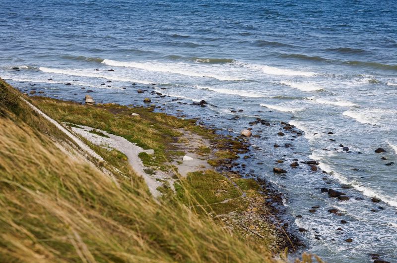
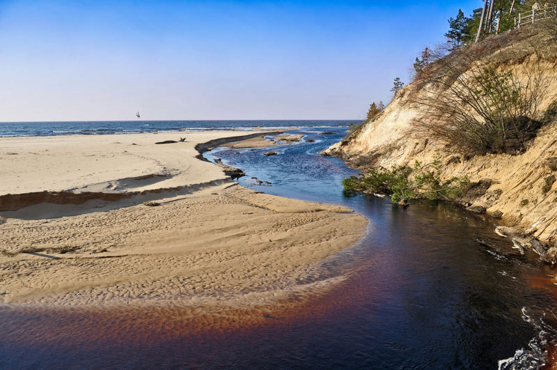
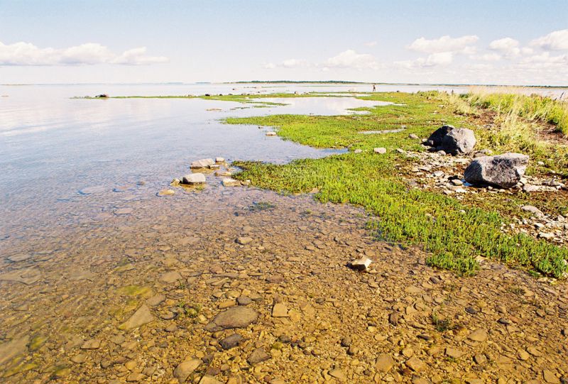
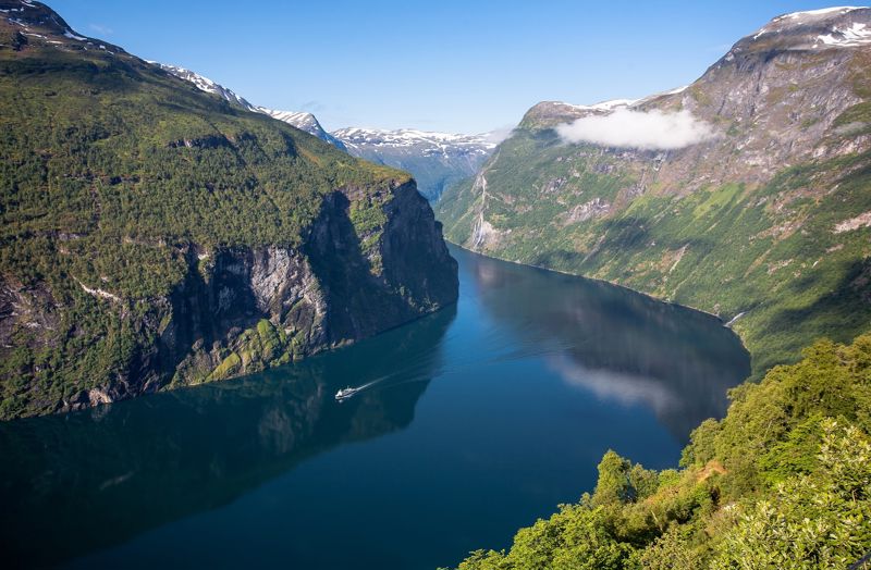
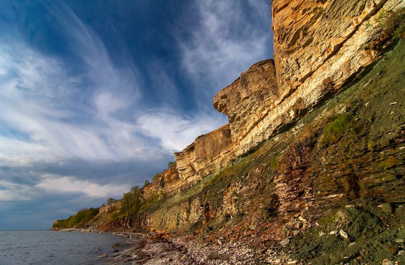
Flat coasts have developed in Estonia, where the coastal sea is slowly becoming deeper. In some places, the beach is sandy and rocky, elsewhere, it rises tens of meters high from the water's edge, so that it is struck by the storm waves. Mud accumulates in the bays where the rivers that flow into them bring nutrients. In these bays, we can usually see a lot of reeds, sometimes several meters high. The opposite of the flat coast is the steep coast, where the seabed gets deep very sharply. Such a coast is, for example, in the Norwegian fjords.
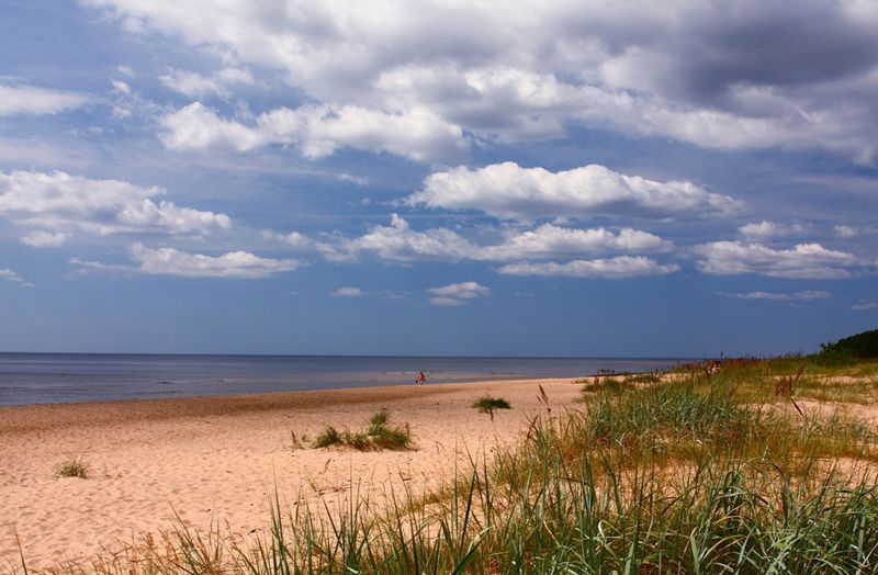
Sometimes the sea recedes and the flat seabed is exposed. Other times, however, the invading water floods the entire shallow beach. Such water level fluctuations are caused by winds. Strong westerly winds bring water to the Estonian beaches from the open sea, and persistent easterly winds raise the water level on the opposite coast of the sea in Sweden or Denmark. The wave height depends on the wind strength, but usually does not exceed 1-2 meters in the Baltic Sea. Only during severe storms are the beaches attacked by 3-4 meter high waves, which hit the shorelines and pile up sand on the shallow beaches.
- flap coast
- steep coast
- flat coast
- step coast
Important terms
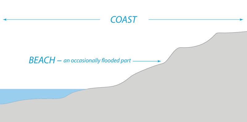
- beach – the terrestrial part of a coast which is occasionally flooded
- flat coast – a shallow coastal area where the land descends gradually into the sea
- steep coast – a coastal area where the land descends abruptly into the sea
I now know that…
The Baltic Sea is the inland sea of the Atlantic Ocean, connected to the ocean by the Danish straits. The coastline of the Baltic Sea is highly articulated. There are nine countries bordering the Baltic Sea - Estonia, Latvia, Lithuania, Poland, Germany, Denmark, Sweden, Finland, and Russia. The shape and coasts of the Baltic Sea have changed a lot over time.