- What types of clouds can we see in the sky?
- How can the shape and height of the clouds help us predict the weather?
- When is air humidity the highest?
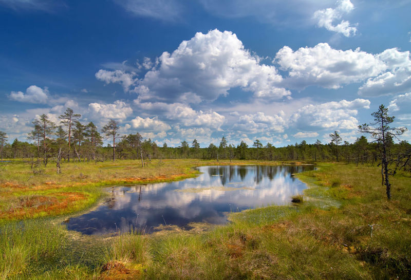
Clouds
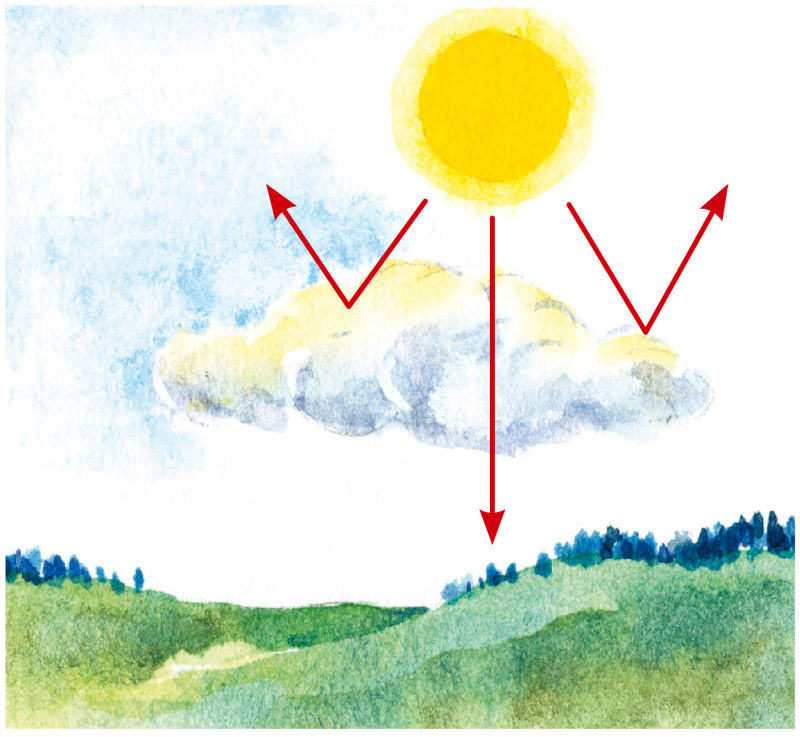
You've probably watched the clouds moving around in the sky. Sometimes they are barely noticeable and sparse like whitish feathers, but sometimes they are thick and dark grey, which makes the environment look grey as the sunlight does not pass through the clouds easily.
- Clouds affect air temperature.
- The appearance of clouds always means that it will rain soon.
- Clouds make the environment darker.
Bonus: Clouds are an indication of the processes that happen in the atmosphere
Different types of clouds bring different weather. Farmers have long known that grain must be harvested before sparse clouds resembling feathers appear high in the sky, because a few days later, the weather becomes rainy. When a threateningly dark thunder cloud appears on the horizon, it was definitely necessary to hurry with haymaking.
When clouds rush across the sky, they only bring occasional showers. However, a cloud layer that stays in one place for a long time can bring about long-term rainfall.
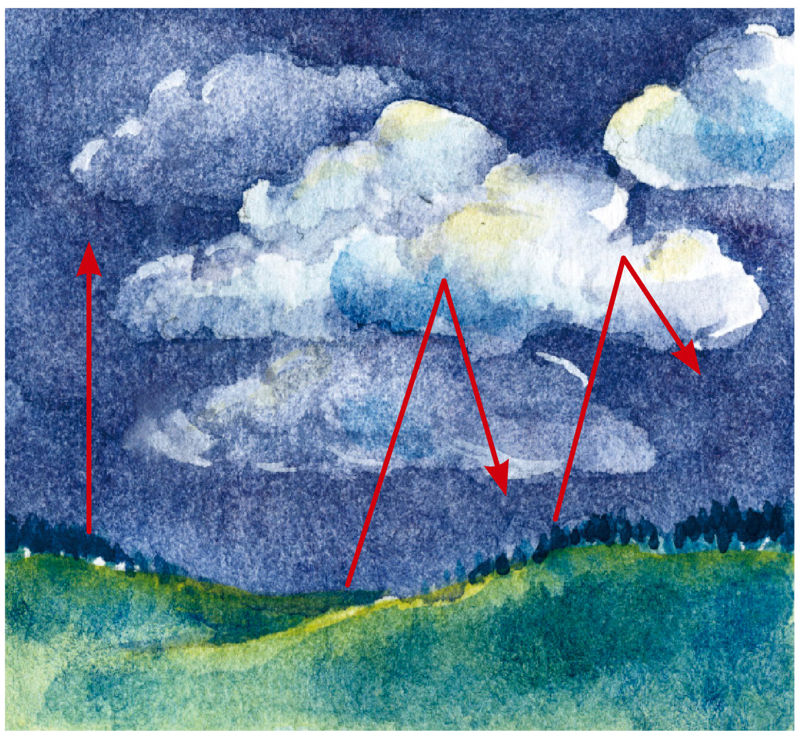
Clouds are distinguished by their shape and height from the ground
The three main types of clouds got their names a few hundred years ago. These names describe the shape of the clouds, however, the cloud types may still be difficult to recognise because no two clouds are alike, and they can simultaneously have the characteristics of several cloud types.
Cirrus clouds are delicate, hair-like clouds found at about 7–10 km above the ground. They are made up of ice crystals because, at a high altitude, the temperature is very low. Cirrus clouds are thin, and the sun shines through them. Even a small movement of air gives the cirrus cloud a new shape.
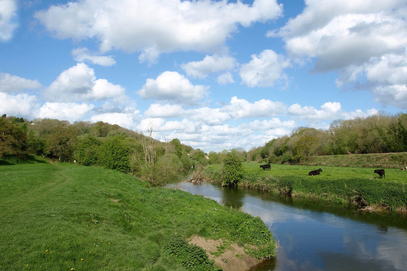
Cumulus clouds are like small piles of wool, formed by rising air currents above the warmed ground. Cumulus clouds are medium-height clouds, usually formed at an altitude of 2 to 6 km, and consist of water droplets and a mixture of snow and ice crystals. They are known as the clouds of beautiful weather.
Especially on hot summer days, the cumulus clouds can grow enormous and take on frightening shapes. These are called cumulonimbus clouds or thunderheads, and they usually lead to storm winds and a short but heavy rain or hailstorm.
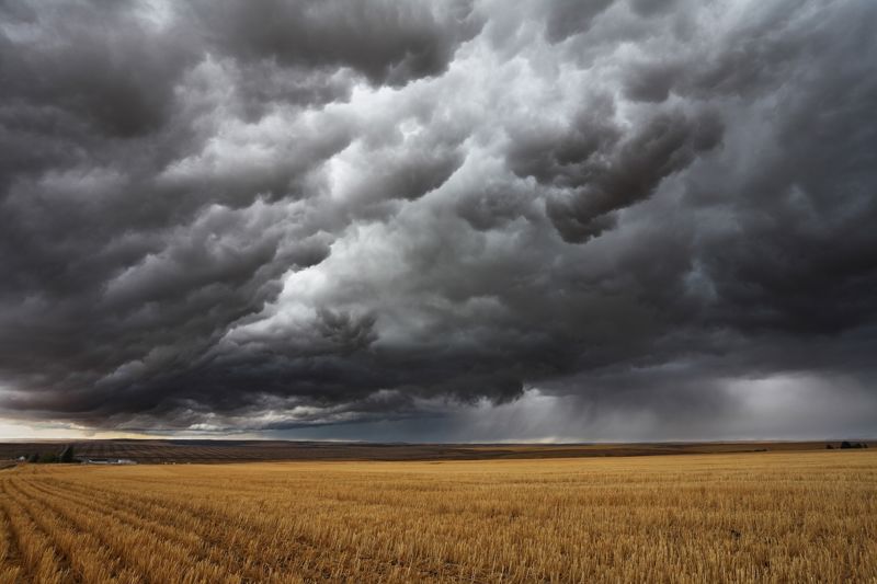
Stratus clouds are low, grey and dense and cover the whole sky in a thick layer. Stratus clouds resemble a thick fog that never reaches the ground. They occur at altitudes of up to 2 km when the cold air has pushed the hot and humid air upwards and replaced it. The warmer air trapped above the cold air cools down, water vapour condenses at the contact point of warm and cold air, and clouds with a layered structure form. Stratus clouds cause heavy and prolonged rains.

- Accompanied by prolonged rain.
- Light, feathery and very high up.
- Appear a few days before the rain.
- Cover the sky like a grey blanket.
- Can turn into thunderheads.
- Made of tiny ice crystals.
- Look like cotton wool.
- Appear in the sky on a sunny summer day.
Humidity indicates the amount of water vapour in the air
There is always some water vapour in the air. Humidity is the amount of water vapour in the air.
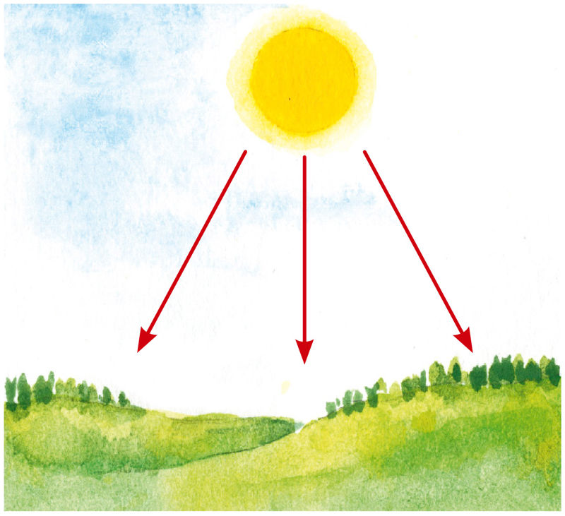
The heat from the sunlight makes water evaporate from everywhere: from water bodies, the ground, plants, and elsewhere. That is why the air above the sea is always more humid than above the land. Humidity can also change in the same location. It depends on the temperature, because warm air can hold more water vapour than cold air.
- The amount of water vapour in the air
- The amount of condensed water in the air
How do clouds form?
The warm air that holds a lot of water vapour rises. As it rises it cools, because it is colder at higher altitudes. For clouds to form, the air must cool down so much that the water vapour condenses into water droplets. These tiny droplets of water and the ice crystals formed at minus degrees form clouds that keep growing larger as long as the air keeps cooling down.
Clouds are made ofwhen the temperature is above zero, and ofwhen it's below zero.
Think!
- Discuss the statement “the sun is the source of clouds” in class.
Humidity depends on temperature
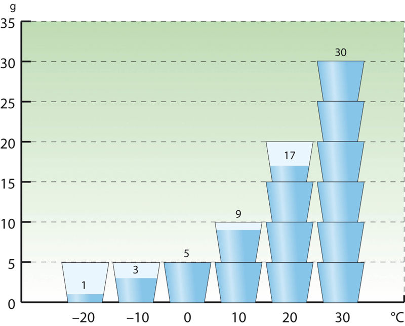
The amount of water vapour that the air can hold depends on temperature. The higher the temperature, the more water vapour the air can hold. This means that the higher the temperature, the higher the humidity can be. Since cold air cannot hold as much water vapour as warm air, clouds form from the remaining water vapour when the air cools down.
The weather forecast sometimes states that the relative humidity is 100%. This means that it is expected to rain or already raining because the amount of water vapour in the air is the maximum amount that the air can hold.
Think!
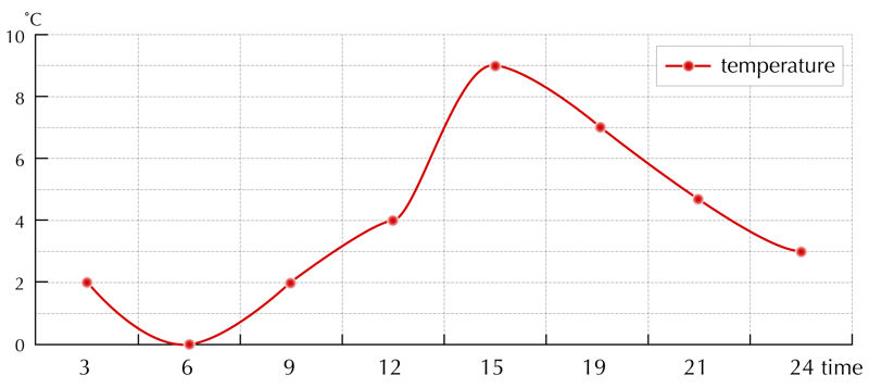
- When is the temperature the highest? How high does it get? How many grams of water vapour could be in the air at that time, before clouds form and it starts to rain?
- When is the temperature the lowest? How low does it get? What is the relative humidity at that time when the amount of water vapour in the air is 5 grams per 1 m3?
Important terms
- clouds – visible collections of water droplets or ice crystals above the ground, formed by the condensation of water vapour
I now know that…
Water vapour gets into the air from land and water surfaces. The warm air that holds a lot of water vapour is light and rises up from the ground. As it rises, the air cools. Cold air can hold less water vapour so the excess water vapour condenses into water droplets, forming clouds. Clouds can be distinguished by their shape and height. The three main types of clouds are cirrus, cumulus and stratus clouds.
- Service provided by Star Cloud LLC